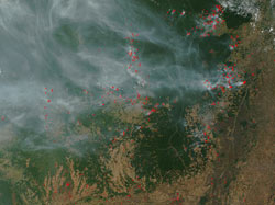
People and Wildlife in the Amazon
This book will be published by Carte Diem Press.
Students manipulate and analyze web-based GIS maps to site a new wilderness preserve and a multi-use reserve in Brazil.
Lesson 1: Consulting Assignment from the Brazilian Government
Lesson Plan: Consulting Assignment from the Brazilian Government
Student Worksheet: Consulting Assignment from the Brazilian Government
Lesson 2: Exploring Data Layers
Lesson Plan: Exploring Data Layers
Student Worksheet: Exploring Data Layers
Lesson 3: Spatial Analysis
Lesson Plan: Spatial Analysis
Student Worksheet: Spatial Analysis
Lesson 4: Recommendation to Brazilian Government
Lesson Plan: Recommendation to Brazilian Government
Student Worksheet: Recommendation to Brazilian Government
Lesson 5: Communicating Science to Policy Makers
Lesson Plan: Communicating Science to Policy Makers
Student Worksheet: Communicating Science to Policy Makers